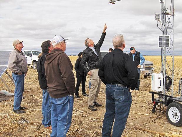
UNL Adjunct Professor Dayle McDermitt explains the equipment used to pick up weather data during a tour of the site in mid-November.
Weather data being collected to help farmers with water use
For more than 30 years, Dayle McDermitt of Lincoln studied both climate and water exchange for Li-Cor Biosciences.
Today, he puts that vast experience to work as an adjunct professor for the University of Nebraska and as a board member of the Nebraska Water Balance Alliance.
The NeWBA wants to insure water for generations to come with a mission of encouraging practical watershed management through team-based approaches to technology, practice and community.
NeWBA has joined with UNL, natural resource districts and other entities that will ultimately help farmers better manage water use on their irrigated crops.
McDermitt oversees a project that measures specific weather data in a 33,459-acre hydrologic unit in Perkins County.
What makes this particular unit unique is that there is no stream water that comes in or out.
McDermitt said that fact makes data collection much easier.
For the past year, a high-tech weather station in the unit has been collecting weather data with a focus on vertical air movement.
McDermitt explained that as air moves down, it contains high levels of carbon dioxide but very little moisture. The carbon dioxide is used by plants, especially corn, in the photosynthesis growing process.
As the air moves back up, it contains varying amounts of water vapor but little carbon dioxide. This water vapor comes from the trans-evaporation that occurs as the result of heat, humidity and wind turbulence.
The station monitors the carbon dioxide, water vapor and wind speed 10 times per second every day. Other data such as precipitation, soil temperature, solar radiation, etc, is collected each second.
McDermitt said the goal is to parse this data into a highly predictable model that can accurately measure the amount of water a crop needs daily.
Eventually, they hope to be able to correlate this data with satellite imagery to predict accurate water use.
Collecting data locally provides for more accurate and reliable information compared to other models currently in use, he said.
